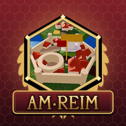
SPQR | AM-REIM — Live Player Count & Stats
AM-REIM - Aeternus Maximus: Roman Era Interactive Map The Roman Empire at its greatest extent, A.D. 117, under Trajan. Every province from Britannia to Mesopotamia is laid out as a hex map you can walk across. Explore 54 regions, Roman provinces and the barbarian lands beyond the frontier. There are 700 cities, legion forts, towns and tribes, 70 named Roman roads like the Via Appia and Via Egnatia, and real rivers, mountains and seas. Hover over the map to see who holds each settlement and how much of its province they control. Families compete for holdings, and whoever controls half of a province’s points can claim its governorship. Check the Factiones table to see who leads the Empire. Use free camera to fly over the map, switch region names on and off, and follow the roads from Roma to the edges of the world. Part of the Senatus Populusque Romanus community.
Live players
0
Peak (24h)
—
Total visits
43
Est. monthly revenue
$0–$0
Estimate (beta)
Player rating
100%
2 favorites
1 likes0 dislikes
Access
Free
Open to everyone
24-hour trend
—
View activity details →
Created on Roblox
Original publication date
Latest Roblox update
As reported by Roblox
Activity over time
Concurrent players
Not enough history yet — check back soon.
Notable change activity
Thumbnail, name, description, and access-price changes only.
No notable changes in 24 hours.
Notable changes
No competitor-level changes tracked yet — SpawnRadar logs every thumbnail, name, price, and description change as it happens.
Embed a live player-count badge
This is the live badge that the code will show on your site.
<iframe src="https://www.spawnradar.com/widget/10770663630" width="320" height="140" frameborder="0" title="SpawnRadar live players" loading="lazy"></iframe>Track SPQR | AM-REIM with SpawnRadar
Get an alert the moment SPQR | AM-REIM changes its thumbnail, price, name, or ships an update — so you never get blindsided by a competitor. Revenue figures are transparent estimates; see our methodology.
Start tracking free